
.jpg)
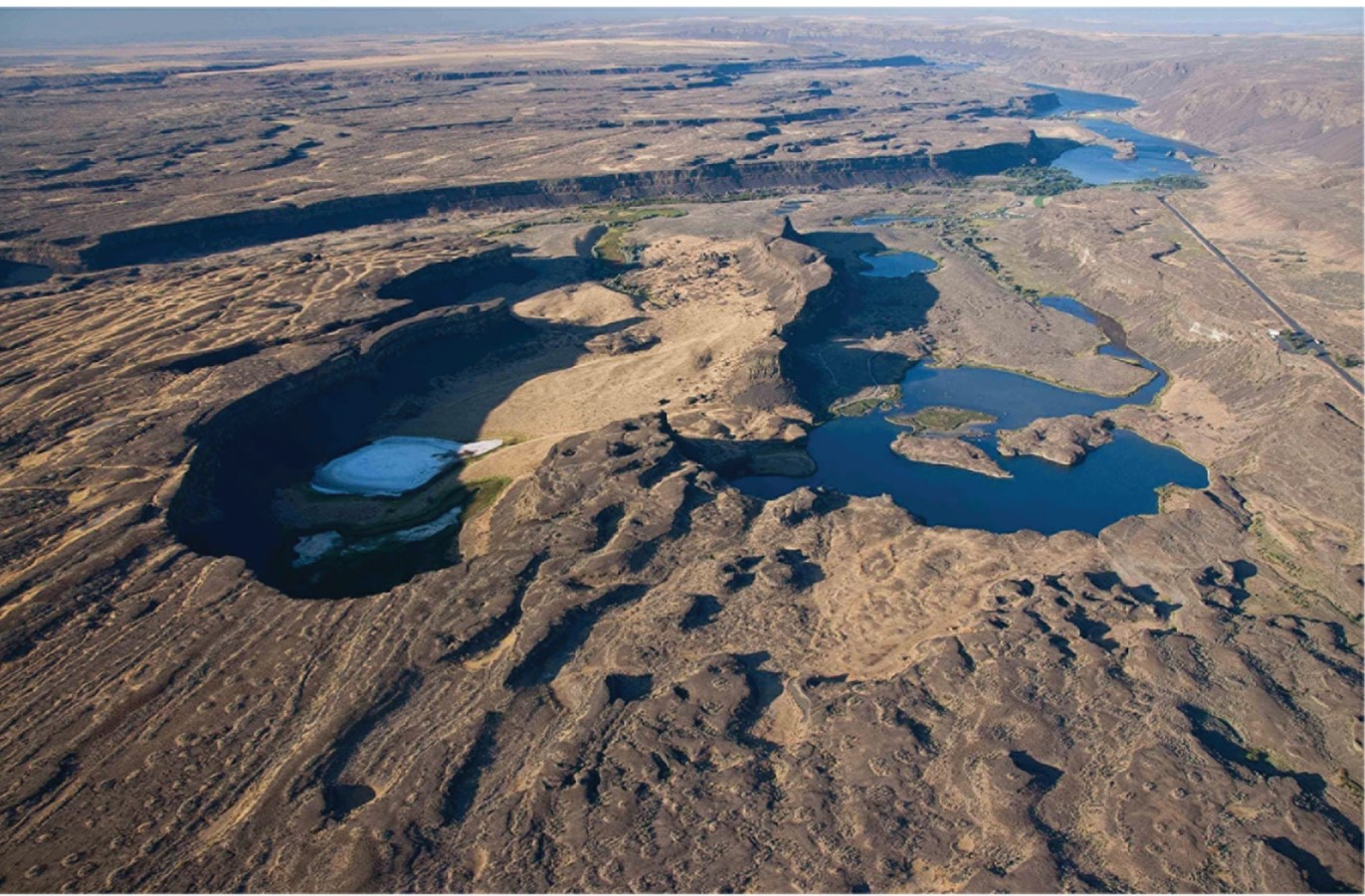
Scenic photo from above of Dry Falls at Grand Coulee, Washington, 400 ft tall, carved by the ice-age Missoula Floods. Photograph by Bruce Bjornstad
The Channeled Scabland of U.S. Pacific Northwest is hallowed ground for understanding ice-age megafloods. Floods from a variety of sources affected the Columbia River and its tributaries but the largest, best known, and perhaps most spectacular were the Missoula floods. At the close of the last ice age, 15,000-20,000 years ago, a lobe of ice flowing south from the Rocky Mountains in Canada blocked the Clark Fork River in northern Idaho and western Montana. The resulting ice-dammed lake, known to geologists as Glacial Lake Missoula, was at times more than 650 meters deep and contained 2500 cubic kilometers of water—20 times the size of Puget Sound. The ice dam ruptured and reformed dozens of times, each break-out sending torrents of water down the Spokane Valley, across eastern Washington and down the Columbia River. The flood waters were in places more than 1000 ft deep and flowed as fast as 100 feet per second, lifting boulders the size of automobiles and tumbling them downstream. With such force, these humongous floods instantaneously transformed the landscape of the Pacific Northwest by carving the Channeled Scablands, rerouting rivers, shaping the Columbia River Gorge, depositing bars of sand and gravel 100s of feet high, and backfilling broad valleys with silt and clay. But more than just shaping the landscape, the floods also steered the science of geology. When these floods were first proposed by early geologist J Harlen Bretz, such catastrophes were loathed by geologists confined by an intellectual framework of slow gradual processes shaping the planet over millions of years. The debate raged for decades, with many twists and turns. In the end Bretz prevailed and we acknowledge such cataclysms as part and parcel of landscape evolution. Nevertheless, surprising findings continue to emerge from study of Pacific Northwest megaflood landscapes, challenging our understanding of one of the greatest events in earth history.
Miles-wide recessional-cataract canyon complex within Grand Coulee.
Jim O’Connor is a Pacific Northwest native long interested in the processes and events that shape the remarkable and diverse landscapes of the region. Following this interest with a Geological Science major at University of Washington and M.S. and Ph.D. degrees at University of Arizona, he has spent most of the last 30 years with the U.S. Geological Survey in Portland, Oregon, focused on understanding the geology of the U.S. Pacific Northwest.